Tuesday, March 29, 2016

The Other Butterfield Overland Trail

Gove County, Kansas
October 7, 2010

This limestone post is one of 138 markers placed from Fort Ellsworth, Kansas to the Colorado state line to mark the route of the Butterfield Overland Despatch. Howard Raynesford mapped the route of this stagecoach line on the Smoky Hill Trail and between 1936 and 1965 placed these markers along the route. The marker consists of a limestone post mounted in a concrete base with BOD 1865 inscribed near the top of the post.

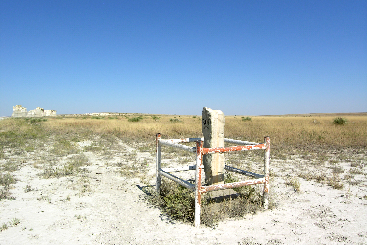
This post marks the trail near Monument Station, a waystation for the stagecoach. One of the reasons why the trail and station are found here is Monument Rocks (also known as Chalk Pyramids), the nearby natural landmark that is visible for miles and miles on these plains. Shortly after the station was established, the U.S. Army soon found it necessary to place troops here, and the military post became known as Fort Monument or Fort Pyramid.

On the concrete base is written:

Smoky Hill Trail
Butterfield Overland
Despatch
Atchison to Denver
Traversed by Gen. Fremont 1844
First Denver Stagecoach 1859
Most Dangerous Overland Route
Retraced and Mapped by
Howard C. Raynesford, Ellis Kansas
Marker Placed 1963


Friday, March 11, 2016

The Outdoors of Vegas

Clark County, Nevada
February 11-12, 2010

I am not one to burrow myself inside a casino during the daytime, and I can only endure so much traffic and solicitors along the Strip. With the February weather in Vegas sunny and in the 70's, I set off into the outdoors of Las Vegas. Yes, there are outdoors to enjoy in the Vegas area that are not made by the hand of man.

I chose three contrasting spots for my Vegas outdoor adventures. One well-known with a Federal designation to recognize its significance. One shown as a small red square on my road atlas with no clues of its worth. One at the end of a long road next to a long waterway.

Tuesday, March 8, 2016

Mauna Kea - The Highpoint of Hawai‘i

Mauna Kea on the Island of Hawai‘i
November 20, 2007

My first state highpoint was an actual mountain summit. However, I have to put an asterisk next to it since I did not do any climbing and by choice I decided not to venture the last two hundred yards or so to the top. Mauna Kea on the island of Hawai‘i is the highest natural elevation in the state of Hawai‘i at 13,796 feet above mean sea level. Unlike most other state highpoints, you can actually view mean sea level below you and can start your journey at tide level at the sea’s edge. I started my journey on a beach near Kailua Kona and then drove to the tour operator that would take us to the top of Mauna Kea.

Tuesday, March 1, 2016

A Day's Drive Through Wyoming

The Middle Part of Wyoming 
July 31, 2010

Wyoming is a land with a lot of open between its communities and long roads connecting them. Wyoming also has a lot of sights, but like its communities, Wyoming's sights are far between. To reach these sights, you must make the effort.

I had an opportunity to make the effort to experience the middle part of Wyoming far from the interstate and enjoy its many historic and scenic spots. This opportunity would be a long day of driving of almost 400 miles. I relied on the red squares of my road atlas, historic markers on the side of the highways, and the expanse of the Wyoming horizon to treat myself to a day of history and scenery.

The Start - Evansville an hour or so into the morning light. I headed westward following the Oregon-California-Mormon Trail that brought so many pioneers to the West in the 19th century.